Today, the land market is becoming more important than ever. Everyone wants to have their own piece of land. So about the matter “Boundary of land plot according to Vietnam law” let’s find with LSX in the article below.
Legal grounds
- Land Law 2013
- Civil Code 2015
- Circular 25/2014/TT-BTNMT
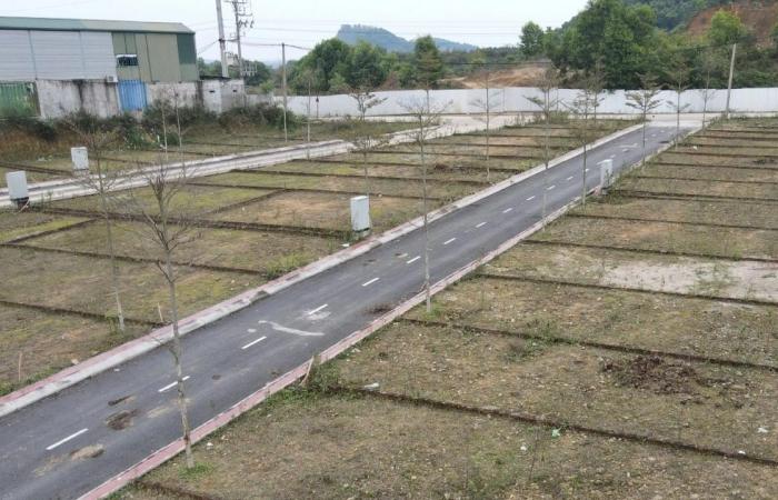
Boundary of land plot according to Vietnam law
The concept of land plot boundaries is specified in Item d, Point 2.3, Clause 2, Article 8 of Circular 25/2014/TT-BTNMT. Specifically, the boundary of a land plot is a curved line created by the adjacent plot edges, enclosing the area belonging to that parcel of land.
Why determine the plot boundary?
The boundary between the land plots will delineate the right of ownership and use of the land with the adjacent land users. Using land in accordance with the boundary is the obligation of all citizens using the land, as stipulated in the 2013 Land Law. Therefore, it is extremely necessary to measure and determine the boundaries of the land plot to create conditions to improve the efficiency of land dispute settlement, if any.
In addition, the measurement and application of descriptive methods also serve the following purposes:
+ Making a red book: also known as a certificate of land use right containing all information about the land, including the area and boundaries of the land plot.
+ Avoiding disputes: In fact, disputes between two adjacent plots of land occur frequently in Vietnam. Therefore, defining boundaries will help resolve disputes. In accordance with Vietnamese law.
+ Dispute settlement: If a dispute occurs on two or more adjacent plots of land in the absence of clearly defined boundaries. The re-measurement of the area is said to be the solution to resolve the dispute.
Define land plot boundary
- Guidelines for determining the boundaries of land parcels
According to Clause 1, Article 11 of Circular 25/2014/TT-BTNMT, the determination of land plot boundaries is as follows:
Step 1: Before taking detailed measurements, the surveyor must coordinate with the surveyor to receive support and guidance in determining the current status and boundaries of land use, together with the users and land management in relation to the land. The agency determines the boundaries and landmarks of the land plot in the field.
The surveyor can be a commune-level cadastral official or an officer of a village, hamlet, residential group…
Step 2: Mark the tops of the land plot with iron nails, paint lines, concrete piles, wooden stakes and make a description of the boundaries and landmarks of the land plot as a basis for measuring the boundaries of the land plot.
Step 3: Request the land user to present the documents related to the land plot (copies can be provided without notarization or authentication).
- The basis for determining the boundary of the land plot
Clause 1, Article 175 of the 2015 Civil Code stipulates the boundaries as follows:
The boundaries between adjacent land parcels are determined by agreement or by decision of a competent state agency.
– Boundaries can also be determined by custom or by boundaries that have existed for 30 years or more without dispute.
– Do not encroach, occupy or change the boundary markers, even if the boundaries are canals, ditches, trenches, trenches or fields. All subjects have the obligation to respect and maintain common boundaries.
In addition to the above provisions, the boundary determination must be based on the provisions of Point 1.2, Clause 1, Article 11 of Circular 25/2014/TT-BTNMT as follows:
– The boundaries and boundaries of the land plot are determined according to the current state of use, managed and adjusted according to the results of the issuance of the Certificate, the effective court judgments, the results of the dispute settlement of the competent authorities, administrative decisions of competent authorities related to the boundaries of the land plot.
– For disputed land:
+ In case there is a dispute over the boundary of the land plot, the measurement unit shall report in writing to the commune-level People’s Committee where the land parcel is located for settlement.
+ In case the dispute has not been resolved within the time of measurement in the locality, but the actual boundary in use or management can be determined, the measurement shall be carried out according to the actual boundary in use or management; If it is not possible to determine the actual boundary in use, the management may measure and draw the boundary of the disputed land plots.
The surveying unit is responsible for making a description of the current status of the disputed land in 02 copies, one copy is kept for the measurement file, the other is sent to the commune-level People’s Committee to take the next steps to settle the dispute according to its competence.
Principles of making a description of the boundaries and landmarks of the land plot
– After determining the boundary of the land plot in the field, the surveyor prepares a description of the boundaries and landmarks of the land plot according to the form specified in Appendix 11 of Circular 25/2014/TT-BTNMT for all the surveyors. land plot, except for the following cases:
+ The land plot has an agreement document or a document defining the land use boundary or landmark with a drawing clearly showing the land use boundary, but the current boundary of the land parcel does not change compared to the drawing on the paper there;
+ The land parcel has a legal document on land use rights which clearly shows the common boundary line of the land parcel with the adjacent land plots and the current boundary status of the land parcel has not changed compared to the current paper;
+ For agricultural land plots, forestry land, salt-making land, aquaculture land with fixed borders or landmarks, clearly in the field, it is not required to make a description of boundaries and landmarks of use. However, after a map showing the current land use status is available, it must be publicly announced at the headquarters of the commune-level People’s Committee and residential areas for at least 10 consecutive days, and at the same time, it must be widely notified to the public. use known land for inspection and comparison;
At the end of the publicity period, a record of certification of the publication of cadastral maps must be made according to the form specified in Appendix 14 of Circular 25/2014/TT-BTNMT.
– In case the land use right legal document has a diagram showing the boundary of the land plot but it is different from the boundary of the land plot according to the current status when measuring and drawing, the description of the boundaries and landmarks of the land plot must show the boundary according to the status quo and the boundary according to that document.
– In case the boundary of the land plot is in dispute, the boundary descriptor and landmarks of the land parcel shall be shown simultaneously according to the current state of use, management and opinions of the concerned parties.
– In case the land user or adjacent land user is absent during the measurement period, the making of a description of the boundaries and landmarks of the land plot shall be carried out by the surveyor, the remaining stakeholders and the guide. The survey is determined according to the field and according to the relevant land plot records (if any). The measurement unit shall transfer the description of the boundaries and landmarks of the land plot set up to the commune-level People’s Committee to confirm their absence and announce it on the loudspeakers of the commune, and publicly post it at the headquarters of the commune-level People’s Committee for users. land use to sign the certification. After 15 days from the date of notification, if the land user is not present and there are no complaints or disputes related to the boundaries and landmarks of the land plot, the boundary of the land parcel shall be determined according to the prepared description.
In case, after 10 days from the date of receipt of the description of the boundaries and landmarks of the land parcel, the adjacent land user does not sign for certification, and there is no document showing the dispute, complaint or denunciation. related to the boundary of the land plot, the boundary of the land parcel shall be determined according to the description already signed by the remaining related parties, the locator shall sign for certification and clearly state the reason why the adjacent land user does not sign for confirmation. Enter in the “reasons for disagreement” section of the Description of the boundaries and landmarks of the land plot.
The measurement unit is responsible for making a list of the above-mentioned cases to send to the commune-level People’s Committee for knowing and keeping the measurement records. (Clause 2, Article 8 of Circular 33/2017/TT-BTNMT)
Services of LSX
Prestigious professional services: Firstly, the team of consultants and consultants for many years in the field of civil status, and customer support.
On-time: Certainly, with the motto “Get your lawyer right at your fingertips”, we ensure the service always performs on time. The rights and interests of customers always come first.
Cost: Besides, LSX’s service costs are highly competitive; depending on the nature of the particular case. So, we want our guests to have the best possible service experience. Therefore, costs which guaranteed to be the most suitable and economical for customers.
Confidentiality of client information: Finally, all brand information of client LSX will be 100% confidential.
Please contact us immediately if you have any questions about “Boundary of land plot according to Vietnam law”
Contact LSX
Finally, hope this article is useful for you to answer the question about “Boundary of land plot according to Vietnam law” If you need any further information, please contact LSX Law firm: at +84846175333 or Email: [email protected]
Please see more
- Can businesses be exempted from land rent when an investment project in Vietnam stops operating
- Land allocation, land lease and change of land use purpose in Vietnam
- Administrative boundaries and base investigation on land in Vietnam
Frequently asked questions
Must make cadastral maps and land declaration books:
– The cadastral map is part of the cadastral record. The location must be clearly shown on the map. The boundary as well as the area of the land plot… From there, you can register the land or issue a certificate of land use right.
– The land declaration book is the result of the investigation. The cadastral survey then summarizes all the information about the land plot. Such as the number of the map sheet, the number of the parcel of land, the type of land, etc.
In Clause 1, Clause 3, Article 5 of Decree 43/2014/ND-CP (amended and supplemented by Clause 4, Article 2 of Decree 01/2017/ND-CP), it is stated that the measurement will redefine the land boundary under the function of the land registry office.
The land registration office functions as a place to register land and land-attached assets; grant certificates of land use rights and ownership of houses and other land-attached assets, for authorized cases as prescribed; to build, manage, update, measure and uniformly adjust cadastral records and land databases; land statistics and inventory; provide land information according to regulations to organizations and individuals that have needs and perform other services on the basis of functions and tasks in accordance with legal capacity as prescribed.
The detailed measurement and drawing of the boundary of the land plot is carried out according to the actual status of use and management determined when determining the boundary of the land plot and making a description of the above mentioned landmarks and boundaries.
– In case of having legal papers on land use rights:
The land parcel has a legal document on land use rights that clearly shows the boundary of the land parcel (with side dimensions or coordinates of the top of the land parcel) but the boundary of the land parcel in the field has changed compared to that document, on the copy The cadastral map must show both the boundary line of the land parcel according to that document (by dashed line) and the boundary of the land parcel according to the current status (by solid line).
The measurement unit must show the change in the boundary of the land plot in the confirmation of the current status of the land plot, made according to the form specified in Appendix 12 of Circular 25/2014/TT-BTNMT.
At the same time, make a list of cases of changing the boundary of the land plot and send it to the commune-level People’s Committee, the Department of Natural Resources and Environment and the Department of Natural Resources and Environment (for the land plot used by the organization) where the land parcel is located for handling according to its competence.
Conclusion: So the above is Boundary of land plot according to Vietnam law. Hopefully with this article can help you in life, please always follow and read our good articles on the website: lsxlawfirm.com